Yellowstone Challenge
Date Started: 6/9/23 Date Finished: 7/03/23
 |
 | |
Yellowstone | ||
| 75mi (121km) | ||
| 6 Virtual Postcards | ||
| 14 Landmarks | ||
 | ||

 Yellowstone River
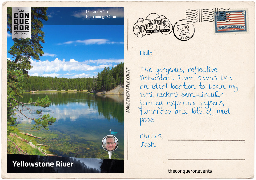
In the northwest corner of Wyoming, United States is the famous Yellowstone National Park. Established by President Ulysses S. Grant in 1872, this 3,468 sq mi (8,983km²) park is home to more than half of the world’s geysers and geothermal and hydrothermal features. Yellowstone is the first national park in the United States and is widely considered the oldest in the world. In 1978 it was designated a UNESCO World Heritage Site.
With its unspoiled forests, mountains, lakes, canyons and rivers, Yellowstone has the largest concentration of mammals in the contiguous United States and more than 1,700 native species of trees and plants.
Taking an anti-clockwise approach to my route, I began my journey at the Mud Volcano Thermal Area. Located near one of Yellowstone Volcano's vents, the area is known for its muddy hot springs and fumaroles. The trail is a loop that's less than a mile (1km) long beginning with the Mud Cauldron, a large, steaming muddy pool. Over a short hill to the left is the boiling pool, Mud Geyser, which used to erupt muddy water up to 50ft (15m) high during the 1800s.
The trail leads to the Churning Cauldron, tossing muddy water. This area used to be a cool pool filled with bacteria until earthquakes in the late 1970s greatly increased its temperature.
Slightly off the boardwalk is the large sizzling Black Dragon's Cauldron. It exploded into existence in 1948 along a crack in the earth, coating the nearby trees in mud. Just beyond the cauldron is the extremely acidic Sour Lake with its milky-green colour. Sour Lake is a result of microbes and the high levels of sulphur found in the area.
Near the end of the trail is Dragon's Mouth Spring, named by a park visitor in 1912. Boiling water rolls out of a cavern nowadays but pre-1994, the water used to spill out like a wave, often splashing water as far as the boardwalk. Steam and gases exploded through the water inside the cavern, emitting strange rumbling noises. Between the noises and spitting water one can imagine the flick of a dragon's tongue, making the name quite fitting.
Many of the trees on this trail are cooked by steam. An earthquake swarm in 1978, that lasted seven months, increased the heat and caused the vegetation to die. This area is known for having the greatest uplift and sinking of Yellowstone's Caldera floor and as such many faults gather here making earthquakes quite common and the hydrothermal features one of the most acidic in the park.
This was a great start. I look forward to discovering more geysers, fumaroles and hot springs. With more than 10,000 hydrothermal features, I suspect there'll be no shortage of bubbling pools, spitting geysers or steamy vents on my trip.

 Canyon Village
To the west of Yellowstone River is Hayden Valley, a sub-alpine valley that sits on an ancient lake bed, once filled by an arm of Yellowstone Lake. Today it is one of the best places to view the free ranging bison herds, elk, grizzly bears and wolves. To protect the wildlife, the valley has only two accessible trails and fishing is prohibited in its waterways.
The valley was named after Ferdinand V. Hayden, a geologist and physician who served during the Civil War. In 1871, Ferdinand led the first federally funded geological survey into Yellowstone. His subsequent report was instrumental in the establishment of Yellowstone as a National Park.
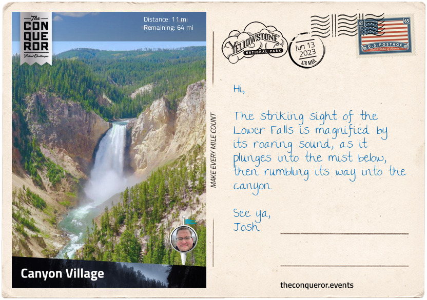
Yellowstone River is the last major undammed river in the contiguous United States. Northbound, it flows into the Missouri River and pours out into the Atlantic Ocean. It has a gentle meander until it suddenly plunges into Yellowstone's very own Grand Canyon, not once but twice. The Upper Falls is the first plunge with a drop of 109ft (33m), then a quarter mile (400m) further is the more thunderous Lower Falls, with a drop of 308ft (94m). Viewing points abound but the best one for the falls is via Uncle Tom’s Trail, down 328 steps to a viewing platform on the side of the canyon.
On the opposite side of the trail is the spectacular view of the canyon and the Lower Falls crashing over the edge. Formed about 150,000 years ago, the canyon wasn’t quite as big as it is today. Hydrothermal activity changed the integrity of the rocks, softening them. These weakened rocks were then eroded by Yellowstone River, carving a much deeper and wider canyon.
With a stunning palette of warm colours, the canyon is a combination of pink, orange, red, yellow and white. Painter Thomas Moran said "…its beautiful tints were beyond the reach of human art." Thomas was part of Hayden's 1871 expedition into Yellowstone. Over a two-week period, he filled a sketchbook with landscapes he saw. He was so enamoured with the colours and vibrancy of Yellowstone’s canyon that upon returning home, Thomas immediately set about painting "The Grand Canyon of the Yellowstone". As the largest American painting of the 19th century (12x7ft/3.65x2.1m), the government immediately purchased it for $10,000. It was the first landscape painting to hang in the Capitol Building, Washington D.C.
Turning in for the day, I pulled into a local eatery for a hearty pot roast with mashed potatoes and lemon garlic green beans. Of course, a good chocolate fudge and a hot cuppa was a great way to wrap it up for the night.

 Norris Geyser Basin
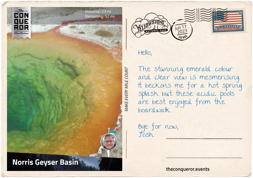
With an easy-going trek from Canyon Village, I arrived at the Norris Geyser Basin, the hottest, oldest and most acidic thermal area in Yellowstone. It was named after Philetus W. Norris, who served as the second superintendent of the park between 1877 and 1882 and was responsible for providing the first detailed report of the basin's thermal activity. He was also instrumental in the construction of the park's first roads.
Sitting at the intersection of three major faults, the basin is prone to regular earthquakes. Yellowstone experiences 1,000 to 3,000 earthquakes per year but thankfully most are never felt. The earthquakes are necessary to maintain hydrothermal activity, acting as conduits for the supply of hot water to geysers and hot springs. Earthquakes generally occur in groupings, where a series of earthquakes happen in short periods of time.
The basin is split into two areas: Porcelain Basin at the top and Back Basin below. Porcelain Basin is a barren area, very much resembling a large expanse of white desert with hot springs, vents and pools located sporadically around the trail. Trees do not survive here. The basin takes its name from the milky color of the mineral deposited there.
The Back Basin is the opposite. Heavily wooded and much larger, the geysers are scattered throughout the area. The most interesting ones were the Steamboat Geyser, known as the tallest geyser in the world (300-400ft/91-122m); Vixen Geyser, with its temperamental eruption that can last from minutes to hours with temperatures as high as 195°F/90°C; Cistern Spring, with its colourful palette of brown, orange and green hues; and Emerald Spring, which at a depth of 27ft (8m) is fully lined with sulphur and gives the spring the stunningly vibrant green colour.
The basin is about 115,000 years old and due to constant seismic activity and water fluctuations the geysers/springs change daily. The highest temperature recorded at Norris was 459°F (237°C) at a depth of 1,087ft (326m) below the surface.
I finished my basin exploration at the Norris Geyser Basin Museum. Built in 1930, the rustic design became a template for hundreds of park buildings constructed during that time. In 1982 it was designated a National Historic Landmark. Today, the museum’s exhibits centre around geothermal activity and life in these areas.

 Midway Geyser Basin
I took a slight detour off my route to visit Gibbon Falls on the Gibbon River. Discovered in 1872 this trapezoidal waterfall had a gradual descent with a drop of 84ft (25m).
Wanting to explore more, I meandered into Firehole Canyon alongside Firehole River. Here I enjoyed the 40ft (12m) drop Firehole Falls and a little further down, I took the opportunity to go for a swim in one of the only two areas in Yellowstone that are sanctioned swimming holes.
Refreshed, I trekked on until I reached Firehole River Bridge and crossed it into Midway Geyser Basin. Once called Hell’s Half Acre, the basin has two of the largest features: Grand Prismatic Spring and Excelsior Geyser.
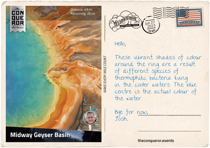
Visually stunning with its multitude of vibrant colours, Grand Prismatic is the largest spring in the USA and the third largest spring in the world. It has a diameter of 370ft (113m) and a depth of 160ft (50m). The spring discharges 2,100 litres of water per minute that reaches temperatures of 160°F (70°C). The prismatic colours closely resemble those seen in a rainbow: red, orange, yellow, green and blue.
For a bit more visual stimuli there is the little Turquoise Pool with its deep ocean blue colour beautifully reflecting the scattering of white clouds beneath the blue sky. Named by the Hayden Expedition in 1878 the pool’s temperature is between 142-160°F (61-71°C).
Lastly, I stopped by the Excelsior Geyser, a dormant geyser crater which today is a hot spring but back in the late 1800s, it would erupt to heights of about 300ft (91m) and just as wide. It used to erupt every 2 mins to 5 hours and lasted anywhere from 1-3.5 minutes. Dormant most of the 20th century, the Excelsior suddenly erupted in 1985 for two days straight, as high as 80ft (24m) and between 2004-2006 it did once more with eruptions up to 10ft (3m). For now, it's back to being dormant.
An incredible location that is as visually appealing on the ground as it is fascinating to see via satellite imaging.

 Old Faithful
A jaunt along the Biscuit Basin Trail led me to the mesmerising Sapphire Pool. The sapphire colour is almost magical and the water is so crystal-clear, I could see to the very depths of the pool. The hot pool was once placid, until an earthquake in 1959 caused it to start erupting every two hours reaching 150ft (46m) in height. The force of the eruption doubled the size of the crater and the water became murky until it settled down again and by 1971 it returned to its once clear blue colour.
Crossing Firehole River, I took the Artemisia Trailhead and trekked along a wooded trail until it opened up to Grotto Geyser, which is part of a group of five geysers that erupt in a particular sequence. The Grotto has an odd shape as the sinter (solid mass that formed during heat without melting) most likely accumulated over dead tree stumps. Erupting every six hours up to 15ft (5m) high, the Grotto often erupts in tandem with the nearby Rocket Geyser. When the Grotto erupts, Rocket is usually splashing. A couple of hours after the eruption, the energy may shift to Rocket erupting and Grotto splashing. Rocket’s eruption may reach as high as 50ft (15m).
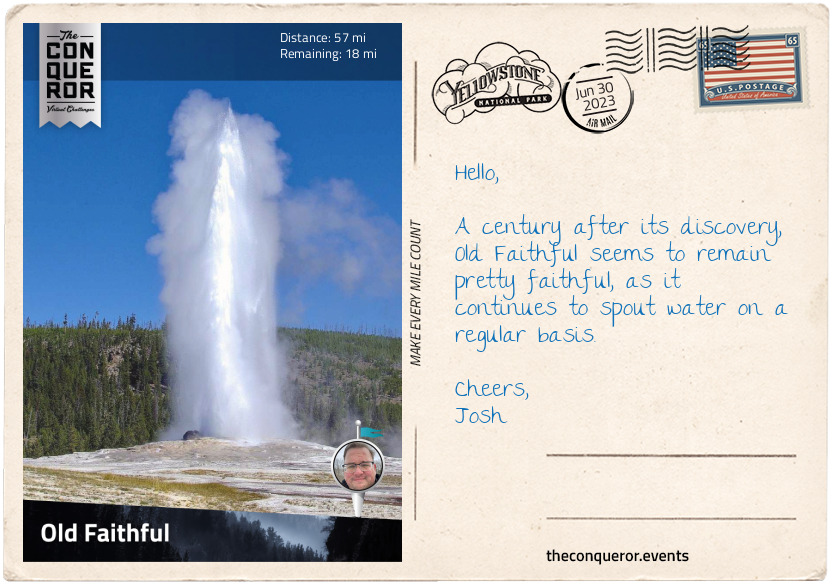
Whilst there are many geysers in this area and I could spend several days exploring each one of them, the main attraction here is Old Faithful. Discovered in 1870, it was the first geyser to be named. Exploding every 90 minutes to a height of 106-185ft (32-56m), Old Faithful has a record 1,000,000+ eruptions. A predictable geothermal feature, its eruptions can be predicted within a ten-minute variation. During these eruptions, Old Faithful expels anywhere from 3,700-8,400 gallons (14,000-32,000 litres) of water.
One quirky story is from the late 1800s when Old Faithful was used as a laundry. During its quiet time, garments would be placed in the crater. When Old Faithful would erupt, the clothes would be ejected, washed, clean as a whistle. However, that depended on whether the clothes were made of cotton or linen, which would survive the ‘wash and hurl’, but if it was wool, chances are the clothes would end up torn to shreds.
Wrapping it up, I retired for the day at the luxurious Old Faithful Inn. A log structure, the hotel was built with locally sourced lodgepole pine and rhyolite stone. The first stage was built between 1903-04 and has since been expanded and renovated many times. The centrepiece is a stone fireplace that weighs 450-metric-tonnes with an 85ft (26m) diameter. It is the largest log hotel in the world. Designated a National Historic Landmark, the hotel and the geyser are part of the Old Faithful Historic District.

 Yellowstone Lake
Having left Old Faithful, I trekked along Grand Loop Road until I took another small detour to see the Kepler Cascades. The viewing platform gave me a wonderful aerial view of Firehole River as it tumbled across several drops and plunged 50ft (15m) below to continue on its course.
Back on the road, I skirted the shore of Scaup Lake, crossed several creeks and arrived at my final destination, West Thumb Geyser Basin, on the shore of Yellowstone Lake. The basin is a boardwalk loop, passing several geysers but the most attractive was the Abyss Pool with its greenish-blue colour. The pool is 53ft (16m) deep and its eruption history is quite recent, having exploded for the first time in 1987. Its eruptions were between 30-100ft (9-30m) high but it stopped by 1992 and has since returned to being a quiet hot spring pool. In 1883, a visitor best described the pool as "a great, pure, sparkling sapphire rippling with heat." The nearby Black Pool has the same beautiful colours.
Another unique and fascinating feature is the Fishing Cone, a geyser on the edge of Yellowstone Lake with its cone protruding out of the water. In the early 20th century, it used to erupt to heights of 40ft (12m) but with the lake’s water level increasing it inundated the cone and cooled it, thereby no longer erupting. It is now considered a hot spring. There was a story of a fisherman in the late 1800s, who caught a trout and tried to fling it ashore but the fish came off the hook and landed into the spring, getting boiled by the searing water. This description was also found in an 1883 tourist manual, “it has often been said that it is possible to catch trout in the Yellowstone Lake and cook them in a boiling spring close behind the angler, without taking them off the hook”. Thankfully thirty years later this practice was banned.
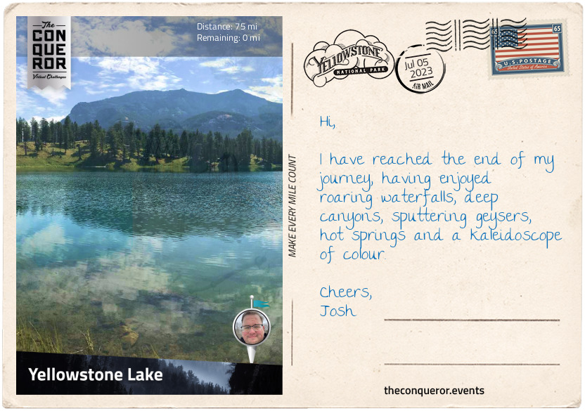
My journey ends on the shore of Yellowstone Lake, the largest body of water in the park and the biggest freshwater lake in North America at 7,000ft (2,100m) above sea level. During winter, the lake’s surface completely freezes and it takes up to six months to fully defrost. With ice as thick as 2ft (60cm), the lake remains cold year-round with temperatures as low as 41°F (5°C). It’s fair to say that swimming is discouraged.
Yellowstone is an incredible national park filled with tall conifer trees, sputtering geysers, colourful pools, meandering rivers and chilly lakes. Its fragile ecosystem deserves to be protected not just for future generations but also for the diverse wildlife that call Yellowstone home.


In addition to the medal below, 5 trees will be planted in my name!
The Conqueror Virtual Challenges, its logo and associated images are owned by ACTIONARY LIMITED.
 Route Map

 Finish Certificate

 Rewards